A GIS based model for wildlife conservation in Sri Lanka
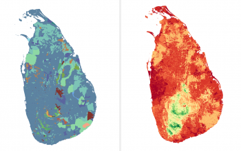
My research is related geo-spatial analyses. Here, based on species distribution data and environmental variables that are spatially-explicit, I plan to conduct the following geo-spatial and geo-statistical analyses using licensed ESRI software, primarily ArcGIS Pro. These analyses include constructing species distribution models, multi-species habitat suitability models based on weighted overlay or weighted sub techniques or map-algebra algorithms, reserve designing, connectivity modelling, and analyse-use and land-cover analyses using non-linear non-parametric modelling methods. These analyses will be largely done using existing tools already available in ArcGIS Pro (spatial analyst, raster calculator, geo-statistical wizard, etc). In addition, using python scripts, I will modify existing tools or create new tools. I am analyzing large sets of data that are high in spatial resolution and extension. Thus processing takes a very long time, which cannot be done on a desktop or a laptop. Plus, some of the analyses, such as reserve designing, can we computationally-intensive. Therefore, I will need access to a cluster computer to run these analyses effectively. Since using MGHPCC cluster computer will require training myself, particularly on communicating with Linux-based OSes, any support on user-training will also be greatly appreciated.